
Magzter GOLD ile Sınırsız Olun
Sadece 9.000'den fazla dergi, gazete ve Premium hikayeye sınırsız erişim elde edin
Denemek ALTIN - Özgür
Lost Roads of the Roman Empire
Scientific American
|June 2026
A massive digitization project has nearly doubled the known extent of the first continent-scale road network
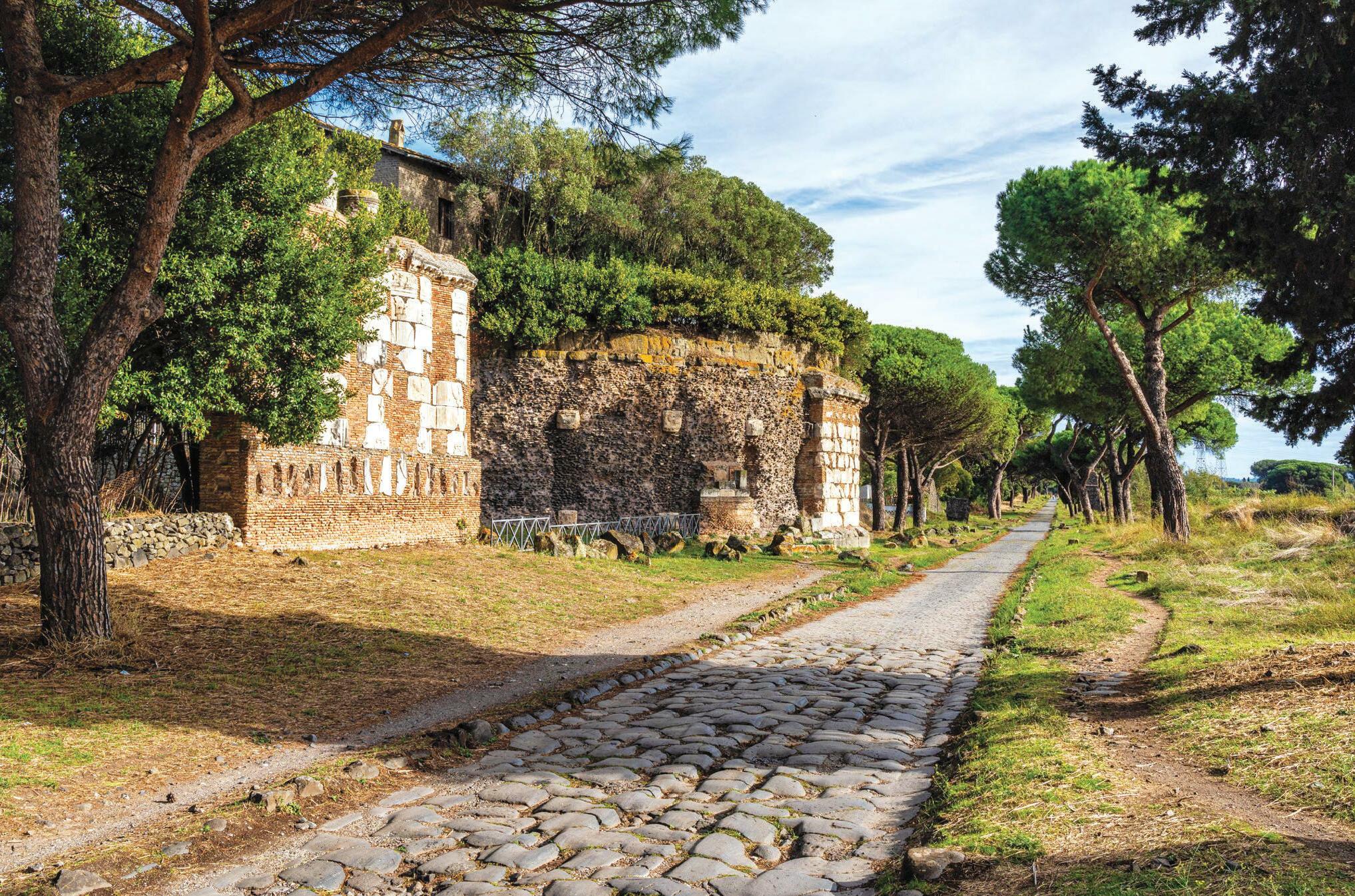
ON A RECENT VISIT to Rome I walked along the Via Appia (also called the Appian Way), past the presumed house of Stoic philosopher Seneca, and felt transported in time. Constructed starting in 312 B.C.E. to carry troops southeast toward Capua and, eventually, the port city of Brindisi in the heel of Italy’s boot, the Via Appia is the oldest and best-known road of the Roman Empire.
Scholars have long regarded it as the quintessential Roman road: a straight highway extending as far as the eye can see, paved with slabs of volcanic stone, lined with pointy cypress trees and, of course, connecting to Rome. It is amazing to know that Romans walked here more than 2,300 years ago. No wonder this marvel of ancient engineering—long stretches of which remain remarkably intact today—is known as the Queen of Long-Distance Roads.
But iconic as it is, the Via Appia is not the archetype researchers have assumed it to be. My colleagues and I have produced a new map of Roman roads that, for the first time, reveals their locations at high resolution in a single, open resource. What we found revolutionized our view of the road system that undergirded this superpower of the ancient world.
Historians and archaeologists have been studying Roman roads for centuries. In that time, they have found remnants of the roads themselves, crumbling milestones, and historical texts about major connections between settlements. But efforts to plot the roads based on these piecemeal sources yielded a low-resolution map of the Empire with approximate locations rather than precise ones.
Knowing the location of Roman roads matters for understanding how the Empire conquered and pacified new territories and transported food to keep its people alive. Their development meant that for the first time in history, an area the size of the European Union was covered by a network that allowed the flow of people, goods, ideas and disease from Egypt to Germany, Spain to Turkey.

Bu hikaye Scientific American dergisinin June 2026 baskısından alınmıştır.
Binlerce özenle seçilmiş premium hikayeye ve 9.000'den fazla dergi ve gazeteye erişmek için Magzter GOLD'a abone olun.
Zaten abone misiniz? Oturum aç
Scientific American'den DAHA FAZLA HİKAYE

Scientific American
War in Plain Sight
Near-real-time satellite coverage means militaries can no longer hide. So they are learning to lie better
4 mins
June 2026

Scientific American
A Bridge-Crossing Puzzle Led to New Math
Are you smarter than an 18th-century Prussian?
5 mins
June 2026

Scientific American
Nocturnal Navigation
These ants use a sophisticated lunar compass
2 mins
June 2026

Scientific American
Early Plates
Scientists found the oldest direct evidence for Earth’s tectonic motion
3 mins
June 2026

Scientific American
Mating Arm
Reproduction in octopuses is even weirder than you think
3 mins
June 2026

Scientific American
Battleship Science
Game-playing AI can show us how to do science better
2 mins
June 2026

Scientific American
WHAT’S A QUANTUM COMPUTER GOOD FOR, ANYWAY?
Quantum computing promises profound power in cryptography, materials design, telecommunications, and much more. But those dreams won’t become reality overnight—if ever
11 mins
June 2026

Scientific American
Atomic Snowflakes
Could each atom in the universe be unique?
2 mins
June 2026

Scientific American
The New Moon Race
The triumphant Artemis II mission marks a new era of lunar exploration and science. Here’s how it went down and what comes next
7 mins
June 2026

Scientific American
What’s Wrong with Quantum Mechanics
A 100-year-old theory might explain the confusion
6 mins
June 2026
Listen
Translate
Change font size