
Gå ubegrenset med Magzter GOLD
Få ubegrenset tilgang til over 9000 magasiner, aviser og premiumhistorier for bare
Prøve GULL - Gratis
THE DAWN OF SUPERSTORMS
TIME Magazine
|September 30, 2024
Earlier this summer, Hurricane Beryl broke virtually every early-season hurricane record. It was the earliest Category 5 storm in history, and the strongest July Atlantic hurricane, with winds of 165 m.p.h. As ocean and air temperatures spike, extreme weather is growing more intense than ever before. This is the dawn of the Superstorm Era and it will only continue to rise, unless we take action to stop it.
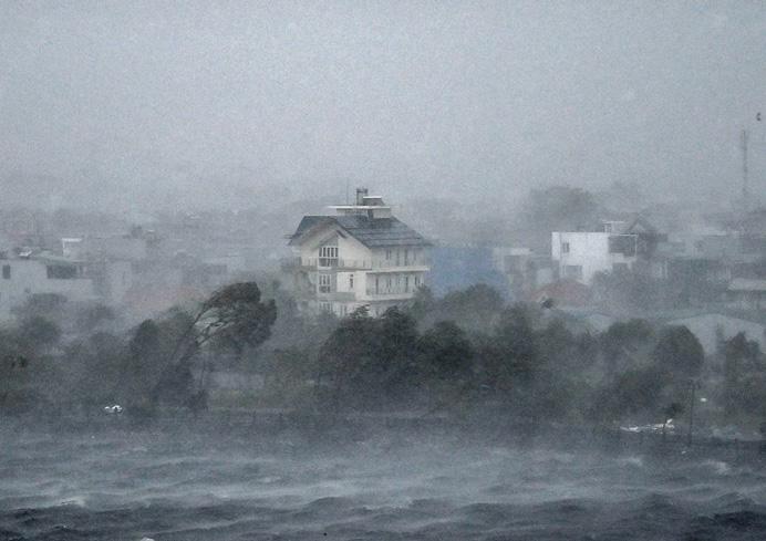
More Category 4 and 5 hurricanes hit the U.S. mainland from 2017 to 2021 than from 1963 to 2016. Hurricanes today also last longer than they once did and move slower, multiplying the damage. Rapid intensification used to spin up once a century, but studies show that in the future, it could occur more frequently-especially in waters bordering the East Coast-putting cities like New Orleans, Houston, Tampa, and Charleston, S.C., at higher risk. By 2100, the number of major hurricanes, including a new breed of "ultraintense" Category 5 storms with winds of at least 190 m.p.h., is expected to increase by 20%.
As with most anthropogenic catastrophes, the effects of climate change are compounding. Storm surge now rides on an elevated sea level, flooding coastlines with walls of water more than 25 ft. high (Hurricane Katrina, 2005). Because the atmosphere holds around 8% more water for every 2°F of warming, storms today carry vastly more precipitation-dumping up to 40 in. of rain in a day (Hurricane Harvey, 2017). One example of how the compounding forces of climate change are overwhelming coastlines, according to climate scientist Kerry Emanuel: if Superstorm Sandy had occurred in 1912 instead of 2012, it might not have flooded lower Manhattan.

Denne historien er fra September 30, 2024-utgaven av TIME Magazine.
Abonner på Magzter GOLD for å få tilgang til tusenvis av kuraterte premiumhistorier og over 9000 magasiner og aviser.
Allerede abonnent? Logg på
Listen
Translate
Change font size