
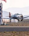
This time, we offer up the RNAV (GPS) Runway 32 approach into Branson’s privately owned, public-use airport (KBBG), sporting a 7,140-foot runway where most of the traffic is itinerant, not local flight training.
A. ALIGNING WITH THE FINAL APPROACH COURSE
Most pilots generally expect vectors to the approach when transitioning from the en route environment, but this isn’t always the most efficient arrival method. Branson’s RNAV (GPS) offers three initial approach fixes posted in a standard T-bar configuration. Approaching from the north or east, a pilot might choose either the AFPAM waypoint or the Dogwood VOR to start the transition. From the south or west, a pilot might choose the Harrison VOR or the UYULA intersection. But why not accept radar vectors? Because using one of these arrival points often establishes an aircraft on a course—and sometimes at a lower altitude than with vectoring. This is the case at KBBG, located some 50 nm from Springfield, Missouri, where the FAA staffs the terminal radar approach control.
This story is from the June - July 2020 edition of Flying.
Start your 7-day Magzter GOLD free trial to access thousands of curated premium stories, and 8,500+ magazines and newspapers.
Already a subscriber ? Sign In
This story is from the June - July 2020 edition of Flying.
Start your 7-day Magzter GOLD free trial to access thousands of curated premium stories, and 8,500+ magazines and newspapers.
Already a subscriber? Sign In
The Temple of Speed
Reno entices even this altitude-oriented pilot.

Flat Sixes
Fanatical artisans
Blue over Green, Tent in Between
I’m old , I’m cranky. Why do I keep air-camping?
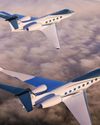
Gulfstream Reveals G400, G800
The product lineup gains large-cabin and ultralong-range mounts.
Every Airplane Requires a Checkout
Embrace the challenge of mastering a new machine.

Fuhggedaboutit
Fifty-plus years of f lying forgetfulness
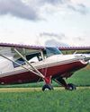
THE MAULE FAMILY APPROACHABLE AIRCRAFT
Choose your mount —the Maules do it all.
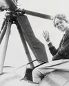
Sisters
“ Women certainly have the courage and tenacity required for long flights.” —Mildred Doran

INSIDE OUT OR OUTSIDE IN?
What kind of pilot should you be?
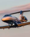
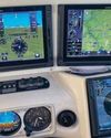
WE FLY: CESSNA CITATION CJ4 GEN2
THE FLAGSHIP CJ JUST GOT A WHOLE LOT BETTER.